Deutsch-Chinesische Enzyklopädie, 德汉百科
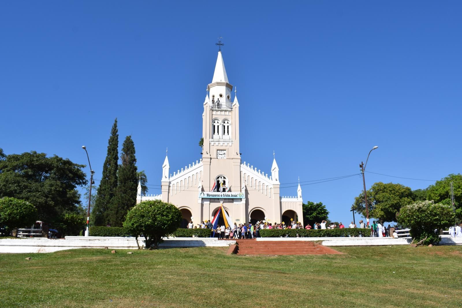


亚松森(西班牙语:Asunción,西班牙语发音:[asunˈsjon])是巴拉圭首都,人口约525,252人(2016年),位于南纬25.2667°,西经57.6667°。亚松森位于巴拉圭河左岸,是巴拉圭的主要港口和工业、文化中心,工业主要有食品工业、纺织工业和烟草工业。
Asunción [asunˈθi̯ɔn, lateinamerikanisch asunˈsi̯ɔn] ist die Hauptstadt und mit rund 525.000 Einwohnern (Stand 2016) zugleich größte Stadt des Staates Paraguay in Südamerika. Ihr Name (spanisch für Aufnahme, Himmelfahrt) steht für Mariä Himmelfahrt, ihr voller Name lautet La Muy Noble y Leal Ciudad de Nuestra Señora Santa Maria de la Asunción. Der Ballungsraum Asunción hat rund 1,9 Millionen Einwohner. Ihre Bezeichnung in der Landessprache Guaraní ist Paraguay (nicht zu verwechseln mit Paraguái, dem Landesnamen auf Guaraní).
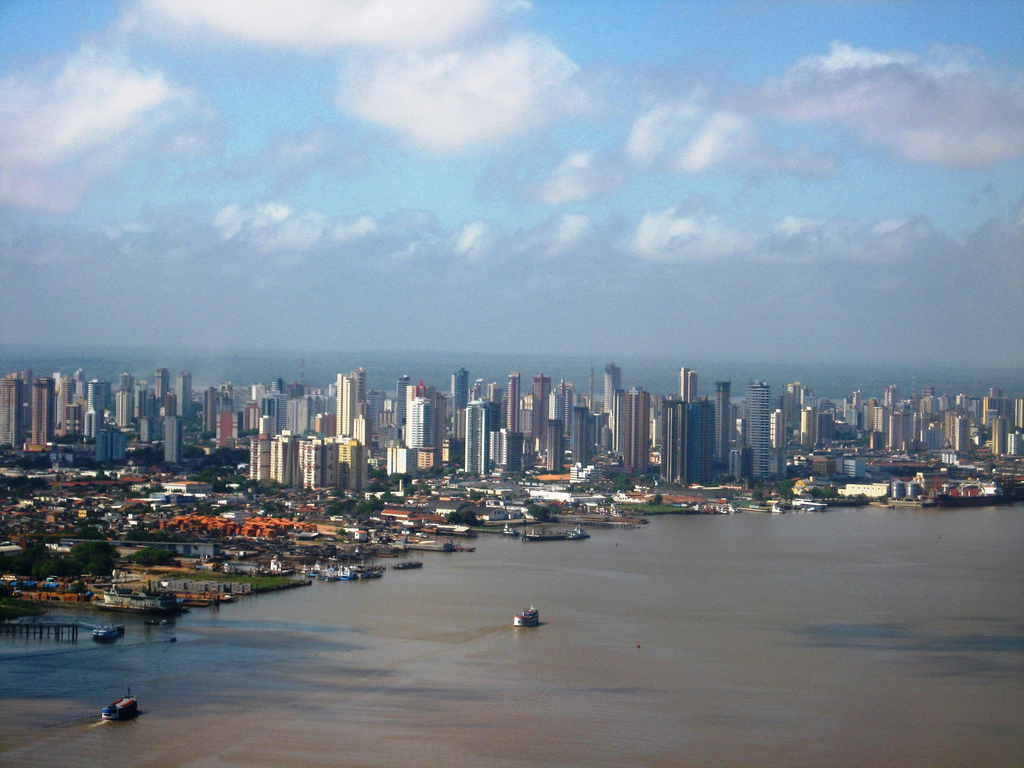
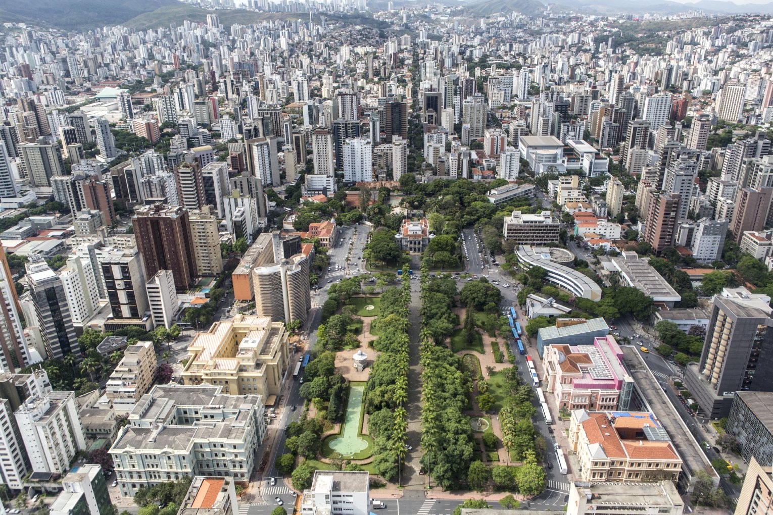


巴西利亚(葡萄牙语:Brasília),又译巴西里亚,是巴西的首都,位于海拔1158米的巴西高原上,亦为联合国教科文组织所列的世界遗产。巴西利亚是全世界最大的20世纪后期建城的城市。
截至2010年,巴西利亚人口已达到2,562,963人,是巴西的第四大城市,拉美的第六大城市,经济总量居巴西第三位、拉美第五位,是拉美大城市中人均国民生产总值最高的,为25,500美元(巴西全国平均水平的近三倍)。[1]
巴西利亚建城于1956年至1960年,以新市镇、城市规划方式规划兴建,其也以大胆设计的建筑物及快速增长的人口而著名,1960年4月21日时,巴西为了加快内陆的开发,将当时的首都里约热内卢迁至巴西利亚。
Brasília [bɾaˈziljɐ] ist die Hauptstadt Brasiliens. Sie liegt im Distrito Federal do Brasil (Bundesdistrikt), der 3 Millionen Einwohner (2017)[1] auf einer Fläche von 5.802 Quadratkilometern hat.
Der Distrito Federal besteht aus einer einzigen Gemeinde (município), Brasília, wobei Gemeinde und Bundesdistrikt rechtlich identisch sind. Der Bundesdistrikt stellt jedoch kein zusammenhängendes Stadtgebiet dar, sondern ist – mit seiner recht geringen Bevölkerungsdichte und den dominierenden Agrarflächen – eher mit einem kleinen Bundesstaat vergleichbar.
Die Kernstadt (Verwaltungsregion Plano Piloto) hatte 205.030 Einwohner (2010) und eine Fläche von 472,12 Quadratkilometern. In der Metropolregion Brasília, die bis in die Bundesstaaten Goiás und Minas Gerais hineinreicht, leben rund 4,29 Millionen Menschen (Schätzung 2016) auf einer Fläche von 55.570 Quadratkilometern.[2]
Das Zentrum von Brasilia ist seit 1987 ein Weltkulturerbe der UNESCO.[3]
ブラジリア(ポルトガル語: Brasília)は、ブラジルの首都で連邦直轄地区。中部の標高約1,100mの高原地帯に建設された、計画都市である。市域の人口は、2016年7月1日で約298万人。同国3位の人口規模を誇る都市でもある。
ブラジル高原の荒涼とした未開の大地(セハード)に建設された計画都市。ブラジル人建築家ルシオ・コスタの設計により建設された計画都市地域は、人造湖であるパラノア湖のほとりに飛行機が翼を広げた形をしており、飛行機の機首の部分に国会議事堂や行政庁舎、最高裁判所が並び、翼の部分には高層住宅や各国の大使館がある。
国会議事堂や大聖堂などの主要建造物は、いずれもモダニズムの流れを受けた未来的なデザインで作られている。これらの公共建築の主任建築家は、ニューヨーク市の国際連合本部ビルの設計も担当したブラジル人建築家オスカー・ニーマイヤーである。
Brasília (/brəˈzɪljə/; Portuguese: [bɾaˈziljɐ]) is the federal capital of Brazil and seat of government of the Federal District. The city is located atop the Brazilian highlands in the country's center-western region. It was founded on April 21, 1960, to serve as the new national capital. Brasília is estimated to be Brazil's 3rd most populous city.[1] Among major Latin American cities, Brasília has the highest GDP per capita. [3]
Brasília was planned and developed by Lúcio Costa, Oscar Niemeyer and Joaquim Cardozo in 1956 to move the capital from Rio de Janeiro to a more central location. The landscape architect was Roberto Burle Marx.[4][5] The city's design divides it into numbered blocks as well as sectors for specified activities, such as the Hotel Sector, the Banking Sector and the Embassy Sector. Brasília was chosen as a UNESCO World Heritage Site due to its modernist architecture and uniquely artistic urban planning.[6] It has also been named "City of Design" by UNESCO in October 2017 and has been part of the Creative Cities Network since then.[7]
All three branches of Brazil's federal government are centered in the city: executive, legislative, and judiciary. Brasília also hosts 124 foreign embassies.[8] The city's international airport connects it to all other major Brazilian cities and many international destinations, and is the third busiest airport in Brazil. Brasília is the most populous Portuguese-speaking capital city. It was one of the main host cities of the 2014 FIFA World Cup and hosted some of the football matches during the 2016 Summer Olympic Games; it also hosted the 2013 FIFA Confederations Cup.
The city has a unique status in Brazil, as it is an administrative division rather than a legal municipality like other cities in Brazil. Although Brasília is used as a synonym for the Federal District through synecdoche, the Federal District is composed of 31 administrative regions, only one of which is the area of the originally planned city, also called Plano Piloto. The rest of the Federal District is considered by IBGE to make up Brasília's metro area.[1]
Brasilia (Brasília en portugais) est la capitale fédérale du Brésil et le siège du gouvernement du District fédéral. Selon un recensement effectué par l'IBGE (Instituto Brasileiro de Geografia e Estatística), sa population en 2010 est de 2 562 963 habitants, faisant d'elle la quatrième ville la plus peuplée du Brésil. Sa construction, à un rythme soutenu, sous l'impulsion du président Juscelino Kubitschek qui souhaitait une meilleure répartition de l’activité économique alors concentrée sur les côtes, date des années 1960.
Brasilia est membre de l'Organisation des villes du patrimoine mondial (OVPM).
Brasilia (AFI: /braˈzilja/[2]; in portoghese Brasília /bɾaˈziljɐ/) è la capitale del Brasile.
È una città pianificata e una delle capitali mondiali edificate e designate più recentemente, essendo stata costruita tra il 1956 ed il 1960 ed essendo capitale dal 21 aprile 1960; in precedenza la capitale del Brasile era Rio de Janeiro. La città è ancora in costruzione, seguendo sempre il progetto iniziale. L'UNESCO ha dichiarato Brasilia Patrimonio dell'umanità.
Brasilia (en portugués Brasília) es la capital federal del Brasil y la sede de gobierno del Distrito Federal, localizada en la región Centro-Oeste del país. Tiene una población de 2 977 216 habs. según estimaciones de 2016 del Instituto Brasileño de Geografía y Estadística,1 lo que la convierte en la tercera ciudad del país por población, además tiene una población de 4 284 676 en la zona metropolitana.2 Es sede del gobierno federal, conformado por el presidente —quien trabaja en el Palacio de Planalto—, el Supremo Tribunal Federal de Brasil y el Congreso Nacional de Brasil.
Брази́лиа[4], или Брази́лия[5] (порт. Brasília [bɾaˈziʎɐ]), — столица Федеративной Республики Бразилии и резиденция правительства Федерального округа[6][7]. Согласно данным переписи населения, проведённой Бразильским институтом географии и статистики в 2010 году, население города составляет 2 562 963 человека, по этому показателю является четвёртым крупнейшим городом страны[~ 1][8]. По количеству ВВП на душу населения Бразилиа находится на втором месте (40 696 реалов), уступая только Витории (60 592 реалов)[9]. Вместе с Анаполисом (139 км) и Гоянией (209 км), составляет ось «Бразилия — Анаполис — Гояния», которая является наиболее развитой областью Центрально-западного региона.
21 апреля 1960 года президентом Жуселину Кубичеком ди Оливейрой столица Бразилии была перенесена в город Бразилиа, ставший третьей по счёту столицей страны после Салвадора и Рио-де-Жанейро. Переезд органов федеральной администрации в новую столицу привёл к тому, что Бразилиа стала центром сосредоточения исполнительной, законодательной и судебной власти.
Проект строительства новой столицы, получивший название «пилотный план» (порт. Plano Piloto), был разработан архитектором Лусио Костой. С учётом рельефа местности и зоны затопления водохранилища Параноа «пилотный план» фактически является адаптацией аналогичного проекта, предложенного Луисом Крулсом (порт.)русск. в 1893 году[10]. Большинство административных и общественных зданий в городе построено по проекту известного бразильского архитектора Оскара Нимейера.
В 1987 году город включён в Список Всемирного наследия ЮНЕСКО.
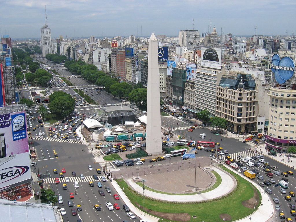
布宜诺斯艾利斯(西班牙语:Buenos Aires,意为“好空气”或“顺风”)简称BA,华人常略称为布宜诺斯或布宜诺。阿根廷政治、经济中心,也是阿根廷最大城市、首都及第一大港。布宜诺斯艾利斯是拉丁美洲第三大都市,都市区拥有1300万人口,素有“南方巴黎”之美称。刚独立时只是小城市,但自从Sarmiento的欧洲化、现代化的政策实施后,吸引了许多意大利、西班牙的移民,成为中南美最欧洲化的城市。七月九日大道(La Avenida 9 de Julio)是世界最宽的马路,有约130米宽(超过16线道)。有名的阿根廷探戈是从这个城市的boca地区发源。
布宜诺斯艾利斯的对面就是乌拉圭,布宜诺斯艾利斯生产总值非常的高,占据阿根廷约一半的GDP,生活水平也是阿根廷最高的。阿根廷布宜诺斯艾利斯拥有很多的美丽风景区,被评为世界第三美丽城市。
布宜诺斯艾利斯自治市(西班牙语:Ciudad Autónoma de Buenos Aires,简称:西班牙语:C.A.B.A.,意为“好空气”),当地华人常略称为布宜诺市或布市,旧译佳气城或布诺赛尔,是阿根廷的首都和最大城市,位于拉普拉塔河(直译:银之河)南岸、南美洲东南岸、对岸为乌拉圭(东方)。2014年,在大布宜诺斯艾利斯地区(Gran Buenos Aires)有常住人口17,180,000[4],是拉丁美洲第二大都会区,仅次于大圣保罗地区(2012年19,956,590人)。布宜诺斯艾利斯为拉丁美洲最欧洲化的城市。七月九日大道是世界最宽的马路,有约130米宽(超过16车道)。有名的阿根廷探戈的发源地就在布市的博卡区(La Boca)。 布宜诺斯艾利斯名字的起源颇有争议,西班牙探险家佩卓·门多萨为了纪念圣母玛丽亚(为美洲大多数的西班牙探险家故乡安达卢西亚和地中海国家水手守护圣人)将这座空气清新的城市称为布宜艾利的圣母玛利亚(Santa María del Buen Aire,“布宜艾利”在西班牙语中是“空气清新”的意思)。
Buenos Aires [ˈbwenos ˈai̯ɾes] (frühere Schreibweise Buenos Ayres; offiziell Ciudad Autónoma de Buenos Aires/Autonome Stadt Buenos Aires) ist die Hauptstadt und Primatstadt, also das politische, kulturelle, kommerzielle und industrielle Zentrum Argentiniens. Ihre Gründer benannten sie nach der Heiligen Santa María del Buen Ayre (spanisch für Heilige Maria der Guten Luft).[2]
Die offiziell nur 202 Quadratkilometer große Stadt bildet den Kern einer der größten Metropolregionen Südamerikas, des Gran Buenos Aires mit etwa 13 Millionen Einwohnern. Sie streckt sich heute rund 68 Kilometer von Nordwest nach Südost und etwa 33 Kilometer von der Küste nach Südwesten aus. Sie wird oft als „Wasserkopf“ Argentiniens bezeichnet, da sich hier fast alle wichtigen Institutionen des Landes befinden und in der Stadt und vor allem in der Umgebung etwa ein Drittel aller Argentinier wohnt. Zudem ist sie als einzige Stadt Argentiniens als „Capital Federal“ autonom, also nicht an eine bestimmte Provinz gebunden. Sie ist ein wichtiges kulturelles Zentrum und wurde 2005 durch die UNESCO mit dem Titel Stadt des Designs ausgezeichnet.[3]
ブエノスアイレス(西: Buenos Aires)は、人口289万人(2010年)[1]を擁するアルゼンチンの首都である[2]。
どの州にも属しておらずブエノスアイレス自治市[3]とも呼ばれる(なお、1880年の首都令以来、ブエノスアイレス州の州都はラ・プラタ市である)。大ブエノスアイレス都市圏の都市圏人口は2016年時点で1,428万人であり、世界第21位である[4]。建国以来アルゼンチンの政治、経済、文化の中心である。アルゼンチンの縮図ともなっている一方で、内陸部との差異が大きすぎるため、しばしば「国内共和国」と呼ばれる。
「南米のパリ」の名で親しまれ[5][6]、南米の中で美しい町の1つとして数えられる。
ラ・プラタ川(Río de la Plata スペイン語で「銀の川」の意)に面しており、対岸はウルグアイのコロニア・デル・サクラメント。
意味はスペイン語で「buenos(良い)aires(空気、風)」の意。船乗りの望む「順風」が街の名前になったものである。
独立当時は「偉大な田舎」と呼ばれる人口5万人程の小さな町だったが、サルミエント (Sarmiento) 政権による欧州化、文明化政策の実施以降数多くの移民がイタリア・スペインなどから渡来し、中南米の中でも最も欧州的な街になった。
かつて南米随一の豊かさを誇ったアルゼンチンの首都として、20世紀において長らくブエノスアイレスは南米最大級の都市であった[7]。1970年代以降のアルゼンチン経済の悪化に伴い、南米最大の都市はブラジルのサンパウロに移ってしまったものの、現在でもブエノスアイレスはスペイン語圏の都市として重要性を保ち、アメリカのシンクタンクが2019年に発表した世界都市ランキングでは24位に評価され、南米の都市の中で首位であった[8]。
かの有名なアルゼンチン・タンゴはこの街のボカ地区で育った。また、サッカーが盛んなことでも有名で、ディエゴ・マラドーナが在籍したボカ・ジュニアーズやCAリーベル・プレートなど名門チームを数多く擁する。
市民はポルテーニョ(porteño, 女性はポルテーニャporteña; 港の人、港っ子の意)と呼ばれる[9]。
Buenos Aires (/ˌbweɪnəs ˈɛəriːz/ or /-ˈaɪrɪs/;[9] Spanish pronunciation: [ˈbwenos ˈajɾes])[10], officially Autonomous City of Buenos Aires, of is the capital and largest city of the Republic Argentina. The city is located on the western shore of the estuary of the Río de la Plata, on the South American continent's southeastern coast. "Buenos Aires" can be translated as "fair winds" or "good airs", but the former was the meaning intended by the founders in the 16th century, by the use of the original name "Real de Nuestra Señora Santa María del Buen Ayre", named after the Madonna of Bonaria in Sardinia. The Greater Buenos Aires conurbation, which also includes several Buenos Aires Province districts, constitutes the fourth-most populous metropolitan area in the Americas, with a population of around 15.6 million.[7]
The city of Buenos Aires is neither part of Buenos Aires Province nor the Province's capital; rather, it is an autonomous district. In 1880, after decades of political infighting, Buenos Aires was federalized and removed from Buenos Aires Province.[11] The city limits were enlarged to include the towns of Belgrano and Flores; both are now neighborhoods of the city. The 1994 constitutional amendment granted the city autonomy, hence its formal name of Autonomous City of Buenos Aires (Ciudad Autónoma de Buenos Aires; "CABA"). Its citizens first elected a chief of government (i.e. mayor) in 1996; previously, the mayor was directly appointed by the President of the Republic.
Buenos Aires' quality of life was ranked 91st in the world in 2018, being one of the best in Latin America.[12][13] In 2012, it was the most visited city in South America, and the second-most visited city of Latin America (behind Mexico City).[14]
It is known for its preserved Eclectic European architecture[15] and rich cultural life.[16] Buenos Aires held the 1st Pan American Games in 1951 and was the site of two venues in the 1978 FIFA World Cup. Most recently, Buenos Aires hosted the 2018 Summer Youth Olympics[17] and the 2018 G20 summit.[18]
Buenos Aires is a multicultural city, being home to multiple ethnic and religious groups. Several languages are spoken in the city in addition to Spanish, contributing to its culture and the dialect spoken in the city and in some other parts of the country. This is because since the 19th century the city, and the country in general, has been a major recipient of millions of immigrants from all over the world, making it a melting pot where several ethnic groups live together and being considered one of the most diverse cities of the Americas.
Buenos Aires [bɥenɔz‿ɛʁ]1 (en espagnol : [ˌbu̯enos ˈai̯ɾes]2) est la capitale et la ville la plus importante de l'Argentine. Les projections pour 2015 établies en 2005 estiment la population de la ville à 3 090 900 habitants3. Son agglomération urbaine, le Grand Buenos Aires, compte 14 500 000 habitants. Les habitants sont appelés « Portègnes4 » (Porteños en espagnol, littéralement « les habitants du port ») ou « Buenos-Airiens5 » (Bonaerenses), nom aussi donné aux habitants de la province de Buenos Aires dont ne fait pas partie la capitale fédérale6. Ils sont pour la plupart d’origine espagnole ou italienne et la religion prépondérante est le catholicisme.
Buenos Aires est située sur la rive sud-ouest de l'estuaire Río de la Plata et le centre-ville se trouve à trente-trois kilomètres au sud-sud-est de l'embouchure du fleuve Paraná. La ville est bordée sur sa façade nord-est par le Río de la Plata (l’Uruguay se trouve au nord-est, sur l’autre rive du Río de la Plata, l'océan Atlantique prolongeant l'estuaire à l'est-sud-est), la Pampa à l’ouest et la province de Buenos Aires au sud. La ville est autonome. Elle possède le port le plus important du pays et est le centre politique et économique du pays. C’est aussi un centre artistique important de la culture occidentale avec de nombreux musées, théâtres, bibliothèques et galeries d'art.
La plupart des rues de la ville se croisent à angle droit, respectant l'ancien plan hippodamien de l'urbanisme espagnol qu'on retrouve dans de nombreuses villes du continent sud-américain. De nombreux immeubles modernes remplacent les vieilles maisons à un étage de la période coloniale.
Buenos Aires[4] ([ˈbwenos ˈaiɾes]) è la capitale e maggiore città dell'Argentina. Soprannominata La Regina del Plata o La Parigi del Sudamerica[4], e nota anche con l'abbreviativo Baires[5]. Oltre a essere la città più popolosa del paese è anche una delle più grandi metropoli sudamericane, la terza dell'America Latina, la seconda dell'emisfero australe dopo San Paolo e la 67ª città più popolata al mondo con i suoi 3 068 043 abitanti, nonché sede di uno dei maggiori porti del continente[6]; l'area metropolitana, nota con il nome di Grande Buenos Aires, conta 14 576 300 persone, mentre l'intera provincia raggiunge i 17 693 657 abitanti, il che lo rende il 4º agglomerato urbano più popolato del continente americano, i cui residenti corrispondono a oltre un terzo dell'intera popolazione del Paese[6]. La capitale argentina, inoltre, è una delle poche municipalità a livello internazionale a possedere lo status di città autonoma, pur essendo compresa nel territorio della provincia omonima, da cui si separò definitivamente nel 1880 in seguito alle Guerre civili argentine mediante un lento processo di federalizzazione[4][7]. La città ospitò i giochi panamericani nel 1951 e 12 partite del Campionato mondiale di calcio 1978, fra cui la partita inaugurale e le finali per il primo e terzo posto; nel 2018 ha ospitato i III Giochi olimpici giovanili estivi e il 13º vertice del G20[8].
Suddivisa in 15 comuni e quindi in 48 barrio, è uno dei più importanti centri politici, culturali e finanziari dell'economia nazionale[4][7] e, in virtù della fitta rete di nodi stradali e autostradali che si diramano lungo la metropoli, funge da principale punto di convergenza per i trasporti di tutta l'America meridionale.[4]
La città fu fondata la prima volta nel 1536 dall'adelantado Pedro de Mendoza. Distrutta dai nativi, fu rifondata nel 1580 dall'esploratore Juan de Garay, e dopo essere stata accorpata al Vicereame del Perù nel 1776 fu designata capitale del Vicereame del Río de la Plata, appena costituitosi per conto del re di Spagna sotto la Corona d'Aragona. Durante la prima delle invasioni britanniche, avvenuta nel 1806, la città fu occupata dalle forze britanniche e rimase per 45 giorni sotto la bandiera del Regno Unito. Nel 1810 ci fu la rivoluzione di Maggio, che spodestò il viceré e diede inizio alla guerra d'indipendenza. Nel 1880, sotto il governo di Nicolás Avellaneda, fu federalizzata, e la città venne separata dalla provincia omonima che la circonda. La "Grande Buenos Aires" è stata una delle principali destinazioni del processo di immigrazione che ha riguardato l'Argentina dalla fine del XIX secolo.
Attualmente occupa il 20º posto nella classifica delle città globali[9]. Nel 2018 la rivista Foreign Policy l'ha inserita alla 91ª posizione nella lista delle 100 città con la più alta qualità di vita, uno dei migliori piazzamenti in America Latina[7][10].
Buenos Aires, oficialmente Ciudad Autónoma de Buenos Aires (CABA) o Ciudad de Buenos Aires (tal y como figura en su Constitución),1011 es la capital y ciudad más poblada de la República Argentina. Esta metrópolis es una ciudad autónoma que constituye uno de los 24 distritos, o «jurisdicciones de primer orden»12, que conforman el país. Tiene sus propios poderes ejecutivo, legislativo y judicial. Está situada en la región centro-este del país, sobre la orilla sur del Río de la Plata, en la región pampeana. La Ciudad de Buenos Aires fue cedida por la provincia de Buenos Aires para que fuera la capital federal del país; pero en virtud de la Constitución Nacional es una ciudad autónoma.
Su tejido urbano se asemeja a un abanico que limita al sur, oeste y norte con la lindante Provincia de Buenos Aires y al este con el Río de la Plata. Oficialmente la ciudad se encuentra dividida en 15 comunas que agrupan a 48 barrios. Desde 1880 hasta el presente se la llama también Capital Federal,131415 aunque desde 1996 no figura oficialmente con ese nombre ni en su Constitución propia16 ni en la Constitución Nacional.17
La población estimada de la ciudad es de 3 075 646 habitantes18 y la del Aglomerado Gran Buenos Aires (conformado por la propia Ciudad Autónoma de Buenos Aires junto a ciertos partidos-municipios de la lindera Provincia de Buenos Aires) es de 17 541 141 habitantes,1 siendo este último el segundo aglomerado de Hispanoamérica, el segundo de América del Sur y una de las 20 mayores ciudades del mundo.1920
Buenos Aires es una ciudad cosmopolita y un importante destino turístico.2122 Su compleja infraestructura la convierte en una de las metrópolis de mayor importancia en América y es una ciudad global de categoría alfa,23 dadas sus influencias en el comercio, finanzas, moda, arte, gastronomía, educación, entretenimiento y principalmente en su marcada cultura.2425 Según un estudio de calidad de vida (2016) de Mercer Human Resource Consulting la ciudad se encuentra en la posición 93 a nivel mundial y segunda de América Latina tras Montevideo.26 Su renta per cápita es de las más altas de la región.2728
Su perfil urbano es marcadamente ecléctico. Se mezclan los estilos colonial español, art decó, art nouveau, neogótico, italianizante, francés borbónico y academicismo francés. Por esto último sumado a su desarrollo edilicio y marcada influencia europea en su arquitectura en determinadas zonas, es que se la conoce en el mundo por el apodo de «La París de América».29
Буэ́нос-А́йрес (исп. Buenos Aires, букв. «хорошие воздухи» или «добрые ветра»; [ˈbwenos ˈai̯ɾes]) — город, столица Аргентины, административный, культурный и экономический центр страны и один из крупнейших городов Южной Америки. Буэнос-Айрес расположен в центрально-восточной части страны, на западном берегу крупнейшего залива-эстуария Рио-де-ла-Плата, являющегося продолжением устья второй по длине реки Южной Америки — Параны́. Своё современное укороченное название — «Буэнос-Айрес» город носит с XVII века. До этого город официально именовался следующим полным именем: исп. Ciudad de la Santísima Trinidad y Puerto de Nuestra Señora de Santa María de los Buenos Aires, букв. «Город Пресвятой Троицы и Порт Богородицы Святой Марии Добрых Ветров».
В Аргентине столицу порой называют «город с разными названиями». Название «Капита́ль Федера́ль» (исп. Capital Federal) — «федеральная столица» является одним из наиболее часто используемых имён города. Часто используется также термин «Город Буэнос-Айрес» (исп. Ciudad de Buenos Aires), или просто «Буэнос-Айрес», хотя это название иногда вводит в заблуждение из-за одноимённой провинции. Название города «Автономный город Буэнос-Айрес» (исп. Ciudad Autónoma de Buenos Aires, сокр. исп. CABA) официально принято уставом города в 1996 году. Часто в просторечии город называют «Ба́йрес» (Baires), это сокращение оригинальной формы, распространённое в городе (особенно среди молодёжи), но такое название не используется в официальных документах[3][4]. Жителей столицы в Аргентине называют «порте́ньос» (исп. porteños), то есть — «обитатели порта».
Город Буэнос-Айрес был основан дважды. Первый раз его основал в 1536 году Педро де Мендоса[5]. При нападении индейцев в 1541 году город был сожжён, а в 1580 году восстановлен Хуаном де Гараем (по настоянию юриста Хуана де Матьенсо[6]). В момент основания и после восстановления, город входил в состав Вице-королевства Перу, которое являлось частью Испанской империи. В 1776 году Буэнос-Айрес стал столицей вновь созданного Вице-королевства Рио-де-ла-Плата.
Во время первого британского вторжения, которое произошло в 1806 году, город в течение нескольких месяцев был оккупирован британскими войсками. В 1810 году произошла Майская революция, во время которой в городе был смещён испанский наместник и сформирован временный правительственный орган — Первая хунта, ставшая первым национальным правительством Аргентины. В начале XX века Большой Буэнос-Айрес стал одним из основных центров иммиграции в Южную Америку. В 1913 году в городе было начато строительство метро, ставшего первым в Латинской Америке.
Буэнос-Айрес также является федеральной столицей, в которой расположено правительство Аргентины. Буэнос-Айрес не является частью одноимённой провинции, а представляет собой отдельный административный район, основанный в 1880 году, который входит в число 24 провинций Аргентины. Официально город разделён на 48 районов, такое деление города утверждено в XIX веке. После конституционной реформы 1994 года город получил право на самоуправление, и глава города избирается прямым голосованием. По переписи 2010 года, численность населения города равна 2 891 082 жителям[1], а в черте мегаполиса Большого Буэнос-Айреса (Gran Buenos Aires) проживает 12 801 364 жителя[1]. Буэнос-Айрес — крупнейший город в Аргентине, восьмой в Южной Америке.
Город Буэнос-Айрес является главным образовательным центром страны. Среди его известных институтов Colegio Nacional de Buenos Aires (Национальный институт Буэнос-Айреса) и Университет Буэнос-Айреса. Буэнос-Айрес стал одним из городов Аргентины, где были проведены матчи чемпионата мира по футболу 1978 года[7].
По индексу уровня глобализации (Global Cities Index) занимает первое место в Южной Америке (2012 год)[8].
В рейтинге глобальных городов GaWC он признан Альфа-городом, стоя в одном ряду с Амстердамом, Москвой и Брюсселем[9][10].


 Internationale Städte

 Weltkulturerbe
 Wichtiger Hafen
